


- Inicio
- Actualidad
- Noticias
- Georeferencing and redefinition of plots and vegetation sampling transects with precision GPS in Pilot Experience of Alcóntar (Andalucía)
Georeferencing and redefinition of plots and vegetation sampling transects with precision GPS in Pilot Experience of Alcóntar (Andalucía)
16 diciembre 2019
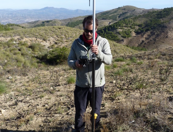
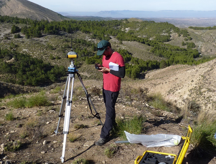
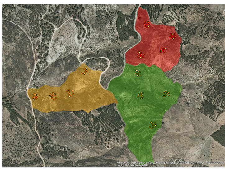
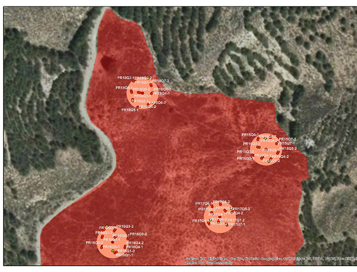
In previous sampling, the location of the plots and transects carried out in the evaluation and monitoring of the vegetation in the PD of Andalusia, have been carried out with conventional GPS. On November 28, 2019, the staff of the Experimental Station of Zaidín (CSIC-EEZ) made a visit to the EP of Andalusia (Sierra de los Filabres, Alcóntar) to georeference with “precision GPS” these plots and (Activity A .1.4) and redefine and rethink the exact position of these plots and transects. It has been differentiated, points of: i) plots of 1 m2 (2 points per plot, located opposite), ii) transects of 20 m (2 per transect, start and end of it) and iii) circular plots of 500 m2 (center of the plot). The georeferencing allows the location of the points with a centimeter accuracy. These new points are necessary to integrate the data obtained in the field sampling with the digital and multispectral images taken with the drone.
The equipment consists of a pair of GPS Base + Rover Kolida K 5 UFO and K5 Plus, being able to reach a horizontal accuracy of up to 2 cm. Two data collection procedures were used depending on the scope of the mobile, differentiating: i) areas with mobile coverage, in which the Rover connects to local services to make corrections and it was not necessary to place the Base, and ii) areas without mobile coverage, the Base responsible for calculating satellite signal distortions and sending corrections to the Rover was used. In total, 211 points were taken corresponding to: 192 plots, 24 transects and 5 additional plots of 500 m2. This information will be incorporated into the geodatabase and will be integrated with drone images for future phytovolume analysis (fuel loading) and vegetation cover.
Compartir:
#CalidadSuelosAplicacionesMedioambiente
-
A pastorícia nas estratégias de valorização e gestão integrada dos territórios rurais: desafios e oportunidades
01 junio 2021

-
Curso de capacitação em tecnologia e qualidade da carcaça e carne ovina,
01 junio 2021
-
Phytovolume sampling in the field and drone flight to estimate phytovolume through images (Alcóntar pilot area, Almería)
09 diciembre 2020
-
Phytovolume sampling. Livestock capacity to control vegetation (Alcóntar pilot zone, Almería)
14 octubre 2020
-
The Portuguese media echo the study carried out by UTAD
29 junio 2020
Follow us


Project financed 75% by the European Regional Development Fund

Universidad Publica de Navarra
Edificio Jerónimo de Ayanz, Campus Arrosadía
31006 Pamplona