


- Inicio
- Actualidad
- Noticias
- PRESCRIBED BURNING, SOIL SAMPLING AND PLACEMENT OF LABELS IN THE ANDALUCÍA PILOT AREA
PRESCRIBED BURNING, SOIL SAMPLING AND PLACEMENT OF LABELS IN THE ANDALUCÍA PILOT AREA
22 mayo 2019
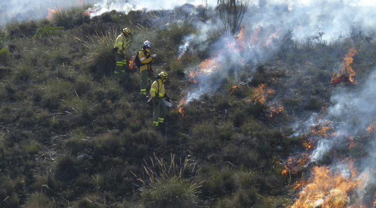
Prescribed burning in pilot area Andalucía (Alcóntar, Sierra de los Filabres) (12/18/2018)
On December 18, 2018, the CMAOT team carried out the prescribed winter burning prescribed in the SUDOE project. These were executed in two zones simultaneously (grazing and non-grazing) with two teams of specialists from the Regional Burning Team of Andalusia (ERQUA). Simultaneously, the Drones Service of the University of Almería took images both during and after the burning. The staff of the EEZ-CSIC was a spectator of the whole process from the beginning of the burning from a safe place.
Sampling of soils after prescribed burning in the Andalusian pilot area (Alcóntar, Sierra de los Filabres) (20/12/2018)
On December 20, 2018, the CSIC / CMAOT team carried out the soil sampling after the burning of December 18. It was observed that the intensity of the burning was different in the different zones, and there were even plots that were not burned at all. A total of 48 soil samples were taken (24 in an area that will be grazed and another 24 in another adjacent area that will not be pastored). The samples were differentiated according to the criteria of fuel load ranges adopted by CMAOT (1: very little load, high percentage of mineral soil, 2: vegetation of a certain height coverage <50%, 3: dense espartal, 4: dense gorse) , criterion that was also used in previous vegetation sampling. In general it was easy to differentiate each of the ranks even though it was burned. Ranges 1 and 2 were often not burned or very little burned.
Placement of labels in the vegetation plots after burning the pilot area of Alcóntar (Andalusia) 06/02/2018.
On February 6, 2019, the personnel of the Zaidín Experimental Station (EEZ / CSIC) made a visit to the pilot area after burning to identify the vegetation sampling plots with metal labels numbered with identification codes. With the help of the photos taken before the burn and the GPS, each of the vegetation sampling points were identified and the labels were placed. In addition, photos of each of the sampling plots were taken to later make a comparison in the laboratory.
Compartir:
#CalidadSuelosAplicacionesMedioambiente

Follow us


Project financed 75% by the European Regional Development Fund

Universidad Publica de Navarra
Edificio Jerónimo de Ayanz, Campus Arrosadía
31006 Pamplona