


- Inicio
- Trabajos en curso
- PILOT EXPERIENCE IN ANDALUCÍA
PILOT EXPERIENCE IN ANDALUCÍA
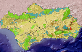
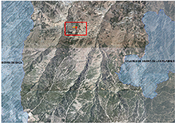
LOCATION
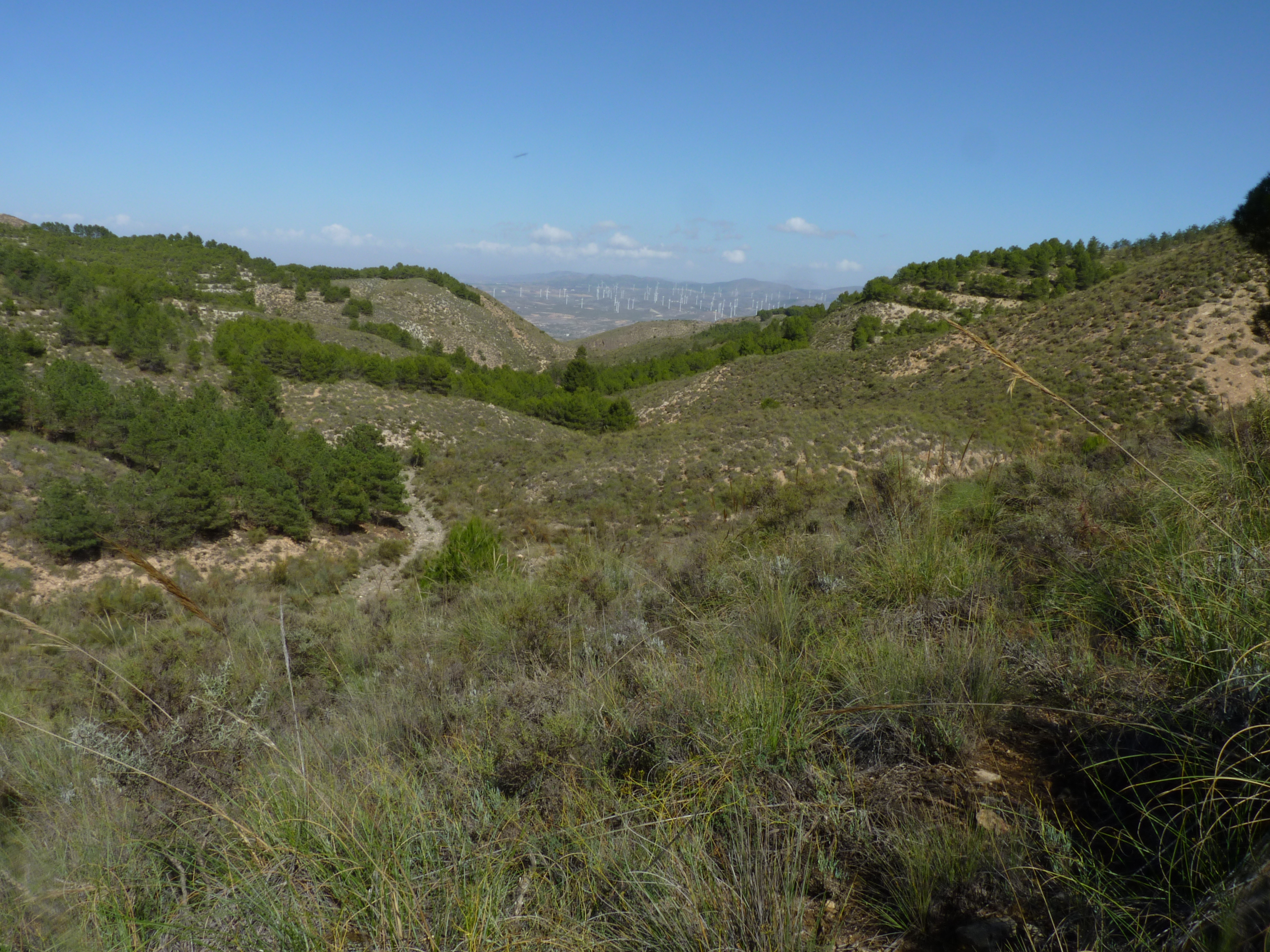
- North side of the Sierra de los Filabres, it is part of the Bética Mountain Ranges.
- Coordinates: 37 ° 18’35.30 “N 2 ° 36’9.67” W.
- Altitude range: Specifically, the Pilot Experience (hereinafter EP) ranges from 1170 m to 1320 m, and the grazing perimeter up to 1450 m. During the summer pasture until 1930 m.
- Municipal Term: The EP is located in Alcóntar, in the Almanzora region (Almería). During the summer pasturing, the municipalities of Serón and Gérgal are contacted.
- Property of the land: Mr. Antonio Blánquez Moreno (owner of the herd). The rest of the grazing area: Junta Andalucía.
PROTECTION FIGURES
The EP is located in the area of influence of two enclaves declared as Special Conservation Zones (ZEC), included in the list of protected areas of the European Ecological Network Natura 2000: Calares de Sierra de los Filabres (ES 6110013, declared in 2015 Decree 2/2015, Boja nº 53 of March 18) and Sierra de Baza (ES6140001 declared in 2012; Decree 76/2012 Boja nº 63 of March 30), in addition the latter is a Natural Park (declared in 1989 by the Andalusian parliament, LAW 2/1989, of July 18, Boja nº 60 of July 27). The distance of the EP to the two ZEC of influence is: 5, 5 km with respect to the first ZEC and 3, 5 km with respect to the second.
SURFACE OF ACTION
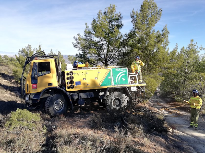
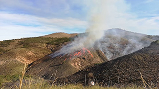
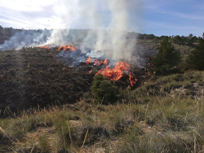
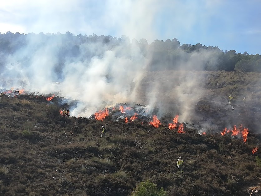
An area of 11.87 ha has been selected for the combined and monitored practices of controlled burning and directed grazing. In it, three plots have been differentiated: a) two (1 and 2: 9.02 ha) with burning in autumn (18 / 12/2018) and, b) one (3: 2.85 ha) with burning in spring . The parcels with burning in autumn present two treatments: without grazing (1: 3, 41 ha) and with grazing (2: 5.61 ha), in them the effect of grazing on the regrowth of vegetation (fuel) will be evaluated. With the burning of spring we try to compare the effect of autumn burning (plot 1) with respect to spring (plot 3). The action area is located in the Domene ravine. The directed exploitation is complemented with other pastures located in the areas close to the EP, which make a total of 3134 ha (public and private forests). During the summer leaves the EP.
WEATHER
The pilot zone presents a dry Mediterranean climate with a clear semi-arid influence that rises through the valley of the Almanzora River. The summers are short, hot and arid, the winters are long, cold and dry, with frequent frosts. The average annual temperature is 13.9 ° C. and the annual rainfall is 444 mm (Alcóntar, at the lowest point of the EP, 925m), with maximums in November. Stresses the irregularity of rainfall, scarce and poorly distributed, with recurrent plurianuales and intense droughts. During summer grazing (higher elevations above 1650 m, precipitation increases (subhumid ombroclima) and temperatures drop.
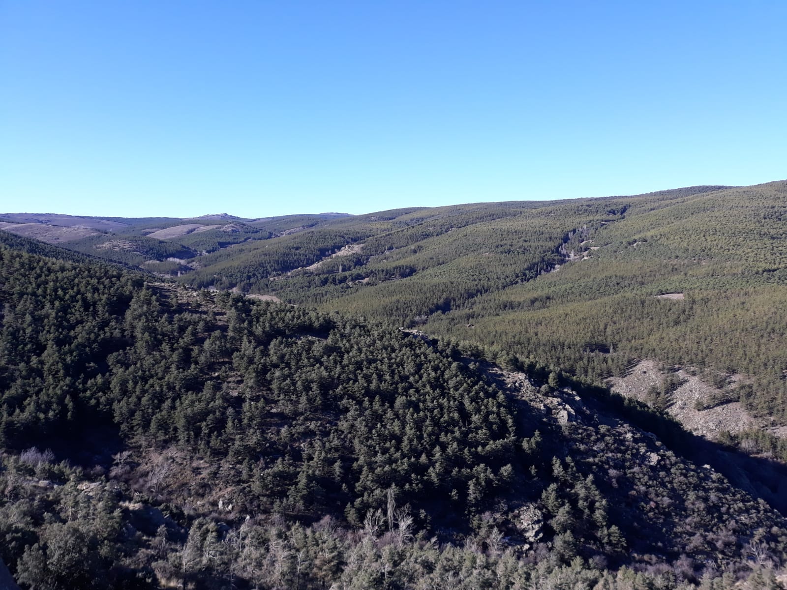
VEGETATION
The potential vegetation is included within the basophilic encinares of medium mountain, of the dry-subhumid bética mesomediterránea series of the holm oak (Paeono coriaceae-Querceto rotundifoliae S.Faciación typical) of the Nevadense sector. The current vegetation is formed by serial thickets, result of the historical action of the man in the territory, today already in abandonment, in which the old crops of marginal dry land (woody and herbaceous) and the mining, combined with the recent repopulations are combined forestry In the EP dominate the aulagares-romerales, dominated by the gorse (Genista scorpius) and espartales, dominated by esparto (Macrochloa tenacissima).
The aulagar-romeral occupies the largest area, developed on stony soils, is a heliophilous shrub with high coverage and high floristic diversity, specifically, the most abundant species in the area are: Genista scorpius (high-medium coverage), Helianthemum almeriense, Bupleurum spinosum, Helianthemum cinereum, Rosmarinus offficinalis, Thymus zygis subsp. gracilis, Lavandula lanata, Teucrium capitatum, Hippocrepis scabra, Koeleria vallesiana, Dactylis glomeratum subsp. hispanica, Avenula bromoides and Poa bulbosa, and accompany him, as witnesses of the retamal, Retama sphaerocarpa and Colutea atlantica. With the former community is interspersed the spartal, vivacious pasture of grasses, characterized by the species: Macrochloa tenacissima (medium-high cover), Helictotrichon filifolium, Sedum sediforme, Avenula bromoides, Arrhenatherum elatius, Dactylis glomerata subsp. hispanica, plus others of the aulagar.
GEOLOGY AND SOILS
Geologically it is framed in the internal zones of the Betic Cordilleras. The dominant substrate is limestone (Alpujárride geological complex) with micachist outcrops (Nevado Filábride complex, Mulhacén mantle) from higher elevations located to the south of the Sierra. Towards the lower zone (north) materials appear, from the Neogene-Quaternary with some inclusions of marls and sands. According to the data of the Andalusian Environmental Information Network (REDIAM), the soils of the experimental zone are classified in eutric cambisols, eugenic regosols and chromic luvisols with lithosols.
ENVIRONMENTAL PROBLEM ASSOCIATED WITH THE PREDOMINANT SPECIES
This area has not escaped rural abandonment and the changes in land use that have occurred in the last 60 years throughout southern Europe, which is accentuated in mountain areas and, even more so in areas with a dry climate, such as the EP In these marginal areas, the abandonment of traditional practices, together with the massive reforestation, has led to the development of woody plant communities of dense and continuous structure, with a high biomass that is very combustible, suitable for the development of fires. After the fire, some sprouting and / or germinating species are enhanced, such as the gorse or aliaga (Genista scorpius) and the esparto (Macrochloa tenacissima), present in the pilot area. The aliaga is a spiny species with an intricate structure, which generates dense, highly flammable and difficult to penetrate by wildlife and domestic livestock. Esparto develops continuous structures of high combustibility and flammability, with very low diversity. These high coverages show no pastoral advantage and cause high intensity fires. These communities endanger repopulations of adjacent pines, easily propagated to the two nearby ZEC of high environmental value. The prescribed burns will contribute to increase the forage production in the area and will also create new preventive structures against fires (firebreaks areas), which may be included in the Network of Fire-Barrier Areas of Andalusia (RAPCA), putting value on the service of directed grazing made by the farmer and his flock, which may be remunerated.
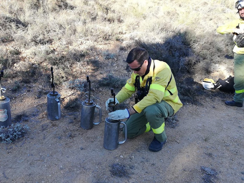
USE OF CONTROLLED FIRE
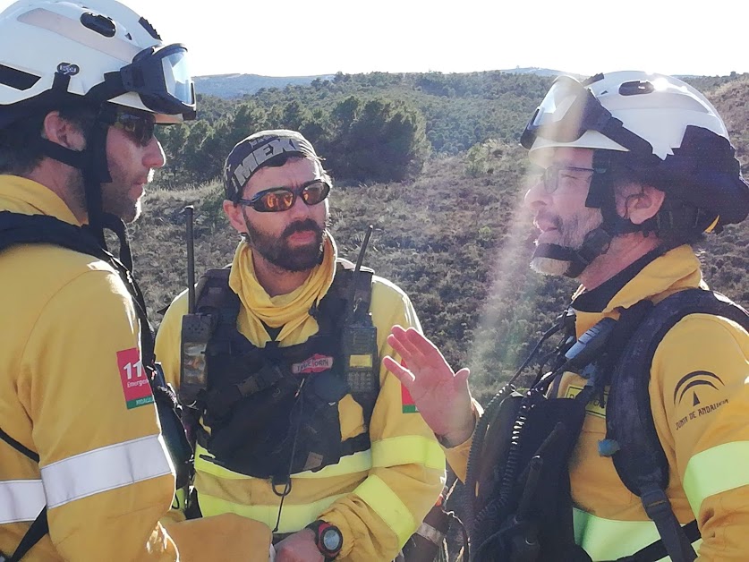
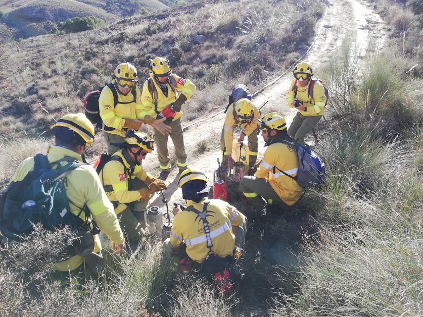
In Andalusia, pastoral burning is a traditional practice, although at present it is not practiced, among other causes, due to the risk of fire that it can generate, especially in these territories with a dry climate. However, there is a series of regulations that regulate the use of controlled fire in forest areas and influence (Law 5/1999 on prevention and control of forest fires, and decrees 247/2001 and 371/2010 that regulate the law and measures to achieve the objectives set), they include the periods allowed for forest and agricultural burning (November to May). In relation to the prescribed burnings, and promoted by the Department of Environment of the Junta de Andalucía (CMAOT), the Regional Burning Team of Andalusia (ERQUA) was created, and they are responsible for carrying out the burning of the forest: develop the procedures for the execution of prescribed prescribed burns, training and accreditation of the personnel that compose the Forest Fire Extinguishing Operative Service (SEIF) integrated in the INFOCA Plan, as well as implement this practice in the Andalusian territory. In Almeria it is where the greatest number of fires have been made (since 2013), mainly centered in the Sierra de Filabres, where the Serón Forestry Defense Center is located, next to the area where the EP is located. So far, this team has never carried out burning for pastoral purposes, only training. In the choice of the pilot area, the experience of ERQUA in the province of Almeria, the domain of a dense, highly flammable vegetable community (aulagar and espartal) of great danger for neighboring repopulations, a committed pastor included in the Network, has been important. of Fire-Barrier Areas of Andalusia (RAPCA, INFOCA) and a sheepfold close to the EP, which ensures grazing in it after burning. In addition to being very close to two ZEC of great environmental interest.
CENSUS OF HERBÍVOROS PASTANTES
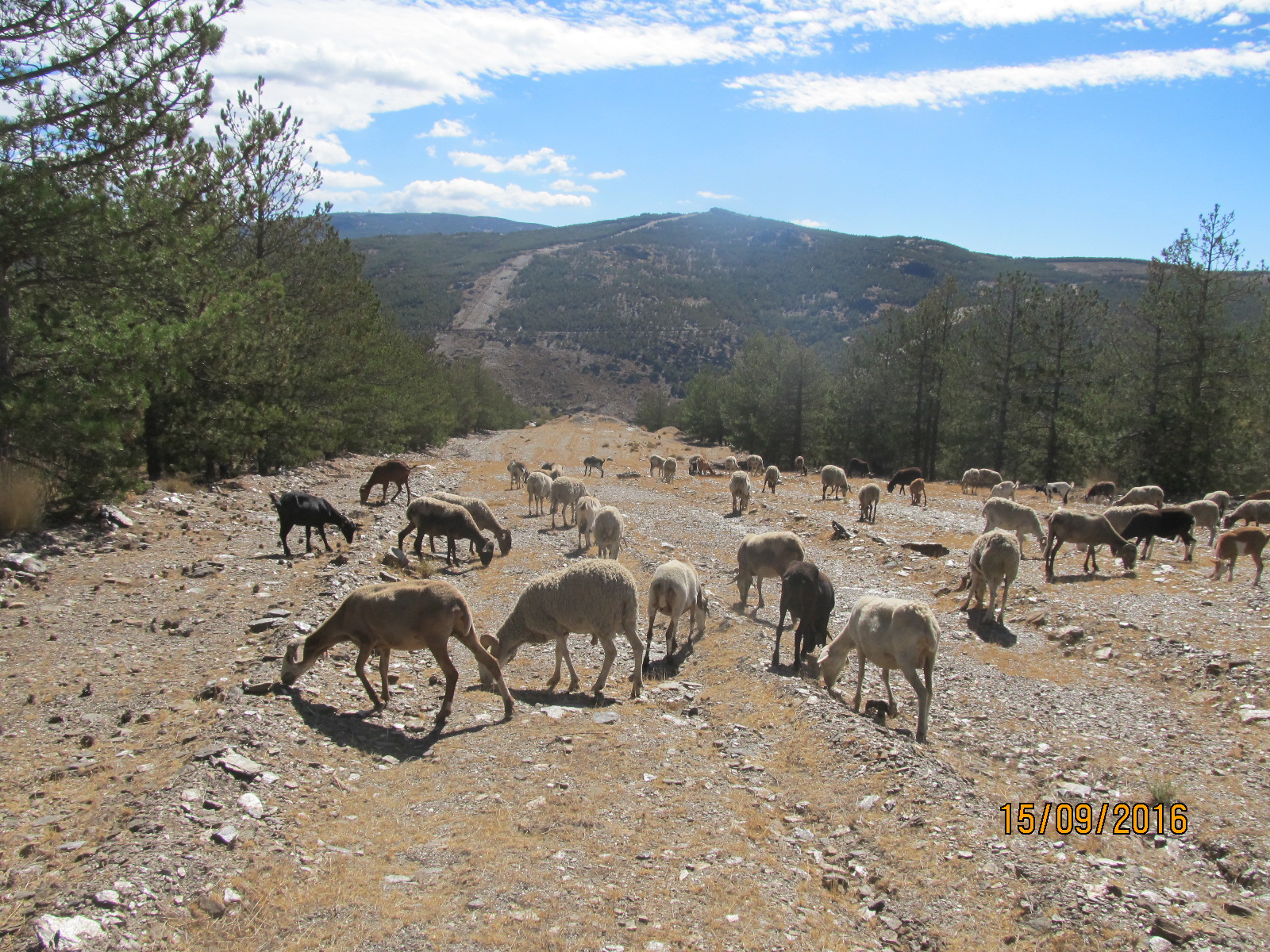
The livestock of the pilot experience is ecological, mainly sheep, with 650 sheep of the “segureña” race and 40 goats of different breeds. The sheep are dedicated to meat production of lamb, this breed is characterized by a high yield (around 51%) and low fatness of the meat. It is a fairly rustic breed, very adapted to the herding in the mountains and the cold winters. Goats are a mixture of different breeds and their main function is to make the lambs wet.
The grazing is conditioned by the lack of pastures during the summer period. Two periods are distinguished: i) the longest, from the beginning of autumn to the end of spring (beginning of October-end of May), and ii) the summer period (end of May to the beginning of October). In the first period, the lowest elevations (1000 m to 1,400 m) are grazed, and the cattle spend the night in the sheepfold located in their shepherd’s farmhouse (1338 m). In the summer period, it rises to a maximum of 1930 m and usually sleep outside the sheepfolds, although there are two in the area. The pastoral days are from 7 to 8 hours. The grazing is directed by the rancher.
In the EP the shepherd will accompany the animals at all times and the grazing of the entire livestock herd is foreseen, except during the breeding season (March-April) that divides the flock into two lots.
LIVESTOCK INFRASTRUCTURES AND ACCESS
The EP is accessed from the Al-6403 road to Alcóntar and then by forest tracks until you reach the Barraco de Domene area where it is located. At a distance of 700 m the farmhouse is located with a sheepfold, owned by the rancher (altitude: 1338 m). This is where the cattle spend the night during most of the year, except during the summer pasture in two plots located in public forests owned by the Junta de Andalucía (De los Santos: E-259 to 1554 m and from the Casillas: E -260 to 1674 m) or directly on the mountain if the weather conditions allow it. In all of them there are water troughs for livestock.
The grazing in the EP is complemented by other pastures located in the nearby areas: the cattle ranch (130 ha), the public forests of the Junta de Andalucía (2103,83 ha: Grupo Montes de Alcóntar) and private lands (900 ha). : hunting ground of Aldeire). During the summer the shepherd leaves the pilot area and climbs the mountain, to public forests owned by the Junta de Andalucía, (3875, 7 ha), mainly from the municipality of Alcóntar and some in Serón and Gérgal). The summer pastures include 21 preventive infrastructures against fires (firewalls: 28.74 km), grazed by this farmer and his flock, included in the Red de Pasto Firebreak Areas of Andalusia (RACPA), contribute to the maintenance of the same. The INFOCA contracts the pastoral service and is renewed annually if the contracted work is fulfilled.
#CalidadSuelosAplicacionesMedioambiente
Follow us


Project financed 75% by the European Regional Development Fund

Universidad Publica de Navarra
Edificio Jerónimo de Ayanz, Campus Arrosadía
31006 Pamplona